
|
|
World Atlas Online Click Here
|

|
Cartographers (or map-makers) face a huge challenge when they try to represent our spherical (round) earth on a flat piece of paper.
To tackle this problem, cartographers have developed various MAP PROJECTIONS, or ways to project a 3-D object onto a 2-D surface. However, by flattening, cartographers can never make a perfect representation. There always exists some kind of DISTORTION. Cartographers choose which element they want to distort, in efforts to preserve what their map is trying to show: 1. The SHAPE of an area can be distorted 2. The DISTANCE between two points can be increased or decreased 3. The relative SIZE of different areas may be altered so that one appears larger than another on the map, but not in reality 4. The DIRECTION from one place to another can be distorted TYPES of MAP PROJECTIONS: There are MANY. However, there are several map projections that are generally used by cartographers: the Mercator, the Goode Homolosine and the Winkel-Tripel projection. Click HERE to see and compare different types of map projections! |
COMMON TYPES OF MAPS

POLITICAL MAP
A Thematic map is a type of map specifically designed to show a particular theme connected with a specific geographic area. Common themes include; climate, vegetation and soil regions.
CLICK HERE to see some true SIZE and SHAPE comparisons!

|
 PHYSICAL MAP PHYSICAL MAP
Physical maps often include much of the same data found on a political map, but their primary purpose is to show landforms like deserts, mountains and plains. Their topography style presents an overall better picture of the local terrain.

|

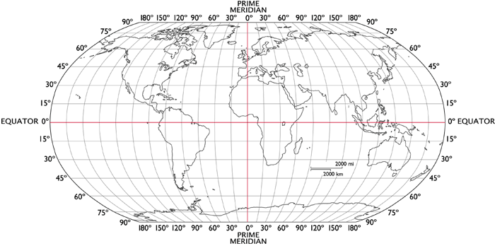
LATITUDE and LONGITUDE
East/West lines are called latitude. Also called parallels. Measured in degrees NORTH or SOUTH of the equator. The EQUATOR is 0 degrees LATITUDE. Lines are numbers from 0 to 90 deg NORTH and 0 to 90 deg SOUTH. Two poles are the highest latitudes.
NORTH/SOUTH lines are called lines of longitude, also known as meridians. Longitude is measured in degrees EAST or WEST of the PRIME MERIDIAN which is located at 0 deg longitude. Lines are numbered from 0 to 180 deg East and 0 to 180 deg WEST. Longitude lines meet at both poles.
|
|
|
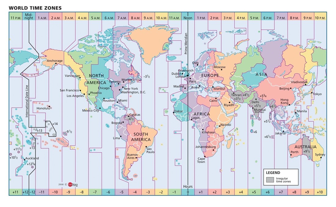
TIME ZONES EXPLAINED
|
|
|
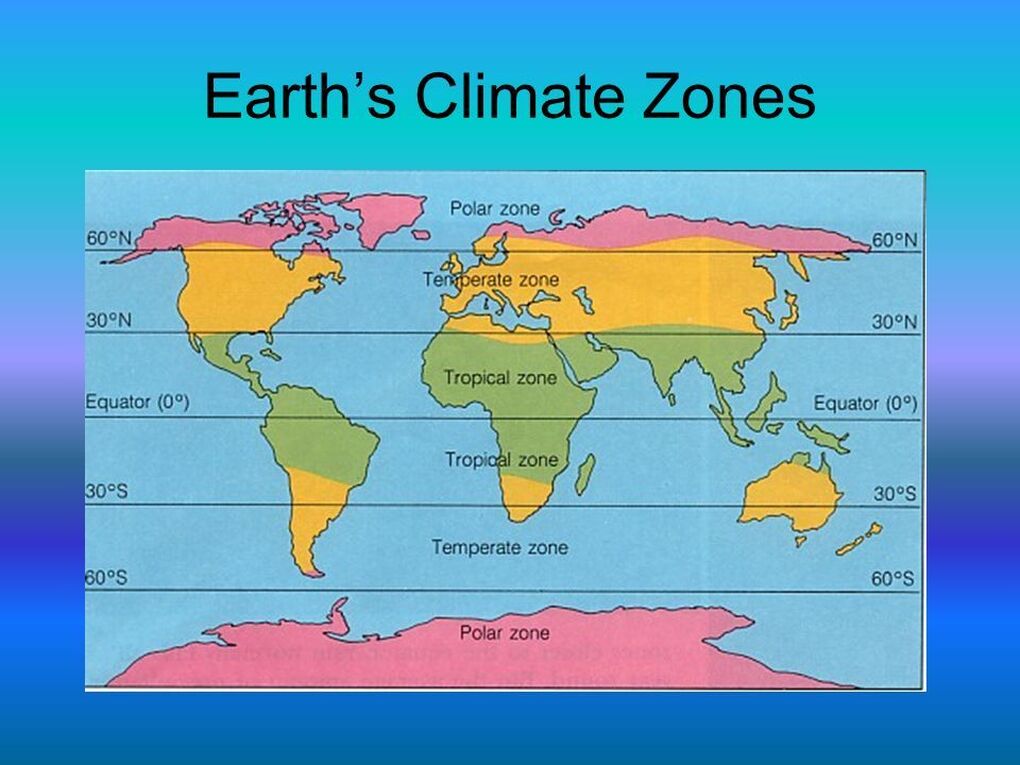
Fantastic Video Series on Climate Zones by GeoDiode CLICK HERE
